Tuesday, July 03, 2007

Bromide native!... you gotta have this if you love Bromide, Oklahoma


In 1977 John Morris published his book, "Ghost Towns of Oklahoma". Bromide was one of the 130 portrayed in his book. He gave special recognition of Bromide on the back cover of his book. Bromide was a booming health resort and in 1911 when the railroad came to Bromide carrying multi-millionaire Robert Galbreath's oil money, the town seemed destined to boom. And it did, for a while.

Bromide is my hometown. My wife and I started the research for this book in 1993, when we visited the Oklahoma Historical Society and copied most of the Bromide Herald issues which were from 1911 to 1915. We recieved permission to use photos from four private collections. We did extensive research of the Indian Territory, the Chickasaws and Choctaws at the National Archives here in Fort Worth. They had the only 1908 town site map of Bromide I could find. We were able to do some research of the early rodeo days in Bromide at the Cowboy Hall of Fame Archives in Oklahoma City. Also a lot of this rodeo information was found in the Herald. And finally a lot of help about the Indian Territory history came from the Chickasaw Council House Museum and the Johnston County Historical Society both located in Tishomingo Oklahoma. The book is 25.00 plus shipping.

This 239 page book, "Bromide Oklahoma Centennial, From Boastown to Ghostown Our Hometown is 8 & 1/2" by 11" soft cover. It contains well over 200 photographs and many documents. "My story" runs through-out but is mostly the last part of the book.

Click here to order book

Bromide is the Blogmaster's hometown to! On the Post Office lists in the book: WL Martin is my dad William Laverne Martin 1900-1955 who spent his whole life in his beloved Johnston county and died on a cold night in December 31st in 1955 on our farm across from Camp Simpson. He has spent most of his life as a cowboy and rufneck. My thanks to the authors of this book. I will treasure my copy.

Friday, June 15, 2007

Visit viewsok.com


Visit the third best opinion blog in North Newcastle, Oklahoma

ViewsOKdotCOM

Friday, May 04, 2007

Friend of Bromide Sherman Barnes writes...


Oh, really? Good gods, it's a small world, eh? ;]

I would have been the tall skinny red haired kid with the .22 and the
big red dog that used to spend his summers up there at Eddy and
Tommy's between about 1968 and 1973, if you lived there then. [I'm 47
now. It has been awhile.]

I don't have any pictures, I'm afraid. I moved from Texas recently
and passed the family photo albumns to my Dad's cousin, Jo Autrey for
safe keeping - didn't want to take any chance of those bits of family
history getting lost while I was relocating.

I don't have many notable annecdotes from that time. I started going
there to visit with my dad when I was eight, and later on, he'd put
me on the Continental Trailways by myself to ride up to Durant where
Eddy would pick me up in that old, black, pickup truck he had had
forever. Or my dad's sister would drive me and the dogs up when I was
able to take them. I mostly spent the summers until going back to
Dallas, anywhere from a few weeks to a couple of months at a time,
doing the usual kids stuff: wandering around the area with a .22 and
fishing rod and my dogs [rabbit and rattlesnake hunting mostly], or
hiking the several miles down to Delaware Creek to fish bass out of
the underhangs and camp overnight. Sometimes with my cousin from
Talequah, most often by myself.

Mostly just good times... I used to love being out by myself as a kid
and prowling those hills behind the store and looking for the old
springs and stuff. And usually getting smacked on the nehind when I
got back because it was supposedly dangerous from all of the snakes
in those chalk hills... although I very seldom saw a rattler or
copperhead, and I looked real hard. ;) [You know how kids are]

One thing that hits me is how times have changed: can you imagine a
9-10 year old being able to travel by himself on Trailways or
Greyhound with a .22 rifle and a .410 in a case today? Without having
everyone come completely unhinged? Back then, no one raised an eyebrow at it.

I don't know if any of them are left there, as I lost track of a lot
of that part of the family in later years, but we used to have some
relatives in Bromide Junction up the road: mostly Greens and Speares
family. I seem to recall that that was where my adopted grandfather,
Granddad Winkler was living when he passed on in his late 80's/early
90's. My father was raised by the Winklers, and spent part of his
early life on the Gillespie ranch down on the Blue River.

If I recall correctly, that was when there was still a bit of a town
left in Bromide: general store, gas station, post office, and
something else. Last time I visited was in 1984 before Eddy passed
on, and it seems that the only thing left was the general store. I
used to walk up to that store a few times a week with my .22 and buy
cokes from the big red coke cooler and .22 long rifle cartridges and
.410 shells at the counter as a kid. Don't know if there's anything
left of the town of Bromide, or in Bromide Junction now?

According to Jo, one of our cousins on the Winkler side of the family
was Sheriff in Johnston County for some time... don't recall if I
ever met him. If we had, it would have been while we were very young
and I'm not remembering.

It's very good to hear from you. And very interesting to find your website.

If I get settled where I can take care of the family albums without
having to worry about them getting damaged or lost, I'll see if I
can't dig out some photos from there and scan them in to the computer
to send to you. We did have some of Tommy and Eddy, and of my dad with them.

Thank you for writing me back,
- Sherman Barnes


At 09:39 AM 5/4/2007, you wrote:
>It is great to hear from you. I knew the Councils our acres were
>just down the road from them across the road from the Scout camp.
>Send me a story about your summers triips to Bromide with dates and
>lot of names and pictures and I will post it on the site.
>I work part time for the State GOP, I am 70 and still have kin in Bromide
>----- Original Message ----- From: "Sherman Barnes"
>To:
>Sent: Friday, May 04, 2007 2:11 AM
>Subject: Bromide Oklahoma
>
>
>>Dear Mr. Martin,
>>
>>I discovered your Bromide, Oklahoma page, "Bromides" while
>>attempting to do some research into the parts of Oklahoma where I
>>spent my summers growing up as a child and young teen. My father,
>>Jack T. Barnes was originally from Bromide, and I used to spend my
>>summers there with my great aunt and uncle. Long time ago, at this point.
>>
>>I was curious on reading through your site, and thought I would
>>email to ask if you were acquainted with my uncle, Eddy Council and
>>his wife Tommy Council? They had a small ranch located just outside
>>of the main junction of Bromide for a large number of years until
>>my uncle's death in the late 80's/early 90's.
>>
>>I hope this email isn't an imposition.
>>
>>Thank you,
>>- Sherman Barnes
>>

Wednesday, November 15, 2006

OpinionOK Dot Com & OpinionsUS Dot Com

This is an online letters to editor dot com. OpinionOK is a superior medium to the print media Opinion pages in that the reader can post their opinion immediately. Topics encouraged are Oklahoma Politics and public interest. Feel free to post replies here or on Google Groups Opinion Oklahoma at bottom of site.


Go to OpinionOK Dot Com

Our Opinions page for national issues

Go to OpinionsUS Dot Com

Sunday, September 17, 2006

CVO Menu - America's Volcanic Past in Bromide Oklahoma

It is noteworthy that Johnston county contains precambrian rock from the creation of Earth.
Quote from the linked article ...
Precambrian

(Beginning of earth - 543 million years ago)
All geologic time before the beginning of the Paleozoic era. This includes about 90% of all geologic time and spans the time from the beginning of the earth, about 3.8 billion years ago, to 543 million years ago. Its name means "before Cambrian." The Precambrian is divided into the "Proterozoic" and the "Archean".


CVO Menu - America's Volcanic Past - Oklahoma: "Arbuckle Mountains

Arbuckle Mountains:1
Granite exposed in the Arbuckle Mountains in Johnston County is 1.4 billion years old. It is the oldest rock exposed between the southern Appalachians and the Rocky Mountains. The Arbuckle Mountains are an area of low to moderate hills in south-central Oklahoma. They contain a core of Precambrian granite and gneiss formed about 1,300 million years ago; in the western Arbuckles, Precambrian rocks are overlain by at least 5,000 feet of Cambrian rhyolites formed about 525 million years ago. Most of the Arbuckles consist of 15,000 feet of folded and faulted limestones, dolomites, sandstones, and shales deposited in shallow seas from Late Cambrian through Pennsylvanian time (515 - 290 million years ago). Folding and uplift of the mountains occurred during several mountain-building episodes in the Pennsylvanian Period.


What is the Precambrian?
What is Granite?
What is Gneiss?
What is Rhyolite?


MORE Arbuckle Mountains:1
The Arbuckle Mountains are an area of low to moderate hills in south-central Oklahoma. They contain a core of Precambrian granite and gneiss formed about 1,300 million years ago; in the western Arbuckles, Precambrian rocks are overlain by at least 5,000 feet of Cambrian rhyolites formed about 525 million years ago. Most of the Arbuckles consist of 15,000 feet of folded and faulted limestones, dolomites, sandstones, and shales deposited in shallow seas from Late Cambrian through Pennsylvanian time (515-290 million years ago). Folding and uplift of the mountains occurred during several mountain-building episodes in the Pennsylvanian Period. The complex mountain area probably was never more than several thousand feet above the surrounding plains and s"

Sunday, August 27, 2006

Save Lake Atoka


Indian Nations Audubon: "Save Lake Atoka
Permanently stop the logging of the Lake Atoka Forest. Establish a park & habitat preserve!
Limit the City of Oklahoma City's opltions.

Friday, April 14, 2006

Vallie Eaves, Major League Pitcher from Connerville


Players Born in Oklahoma - Baseball-Reference.com
: "A total of 220 players were born in Oklahoma
Batters Born in Oklahoma
BELOW: Pitching Register / Manager Register"
Vallie Eaves was from Connerville, Oklahoma and married my dad's cousin and I met him a few times. I see my Eaves cousins from time to time. They own resturants in the metro area. His decendants are prominate in central Oklahoma Little League and School Baseball. In an interesting game a few hears ago my grandson played againest one of the Eaves. They were both pitchers. The Eaves won that game and I am sure his great grandfather Vallie Eaves is proud. Vallie's record is published on the link above along with all 220 players from Oklahoma so far

Saturday, April 08, 2006

Boggy Depot Townsite - Atoka, Oklahoma - brought to you by LASR - Leisure And Sport Review

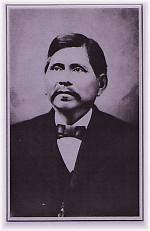
Chief Allen Wright
Boggy Depot Townsite - Atoka, Oklahoma - Leisure And Sport Review: .

Oklahoma named by Bromide/Atoka area local resident..
"Chief Allen Wright, principal chief of the Choctaw Nation, suggested the word 'Oklahoma' (meaning 'Red People') in 1866 as the name for the proposed Indian Territory. In 1907 the word was made the official state name. The Townsite and adjoining Cemetery are listed on the National Register of Historic Places and on Oklahoma's list of Oldest Historical Places.".

Battle of Boggy Creek 1864


Union Official Records Report of the Battle (O.R. SERIES I VOLUME XXII/2 S# 33)

Early in 1864 approximately 1,500 Union soldiers under Colonel William A. Phillips set out on an expedition to cut a swath through Confederate Indian Territory from the Arkansas River to the Red River.

The Purpose was to bring the area under Union control and to offer the amnesty terms provided in President Lincoln's Emancipation Proclamation of the previous December. Colonel Phillips wanted not only to sever Confederate treaties with the tribes, but also to gain recruits from the Indians. Before departing Fort Gibson, Colonel Phillips told his men, "Soldiers! I take you with me to clean out the Indian Nation south of the river and drive away and destroy rebels. Let me say a few words to you that you are not to forget .... Those who are still in arms are rebels, who ought to die. Do not kill a prisoner after he has surrendered. But I do not ask you to take prisoners. I ask you to make your footsteps severe and terrible. Muskogees! (Creeks) the time has now come when you are to remember the authors of all your sufferings; those who started a needless and wicked war .... Stand by me faithfully and we will soon have peace ...."

On February 9 the Union troops reached the Boggy Depot area, where Colonel Phillips camped to wait for a large part of the 14th Kansas Cavalry under Colonel Thomas Moonlight to arrive from Fort Smith.

While waiting, Colonel Phillips sent an advance of about 350 men under Major Charles Willets to a known Boggy Depot outpost on Middle Boggy River (now known as Muddy Boggy). This force consisted of three troops of the 14th Kansas Cavalry and one section (two guns) of howitzers commanded by Captain Soloman Kaufman.

The Confederate forces at Middle Boggy may have numbered as many as 90 men and no artillery. They were composed of Captain Nail's Company "A" of the First Choctaw and Chickasaw Cavalry, a detachment of the 20th Texas Cavalry, and a part of Lieutenant Colonel John Jumper's Seminole Battalion of Mounted Rifles.

The Confederate forces were completely surprised when Major Willets first shelled and then attacked them. The Confederates fought desperately for approximately thirty minutes before scattering into the surrounding woods, dashing for the safety of Colonel Jumper and the remainder of his Seminole Battalion who were camped at Boggy Depot.

Colonel Jumper and his troops had heard the howitzers firing and had begun to ride toward the encampment when they met Captain Nail and the survivors of the battle.

By the time Colonel Jumper's regiment and the survivors arrived at the battlefield, Major Willets had occupied Middle Boggy, learned of the approaching Seminoles, and retreated to Colonel Phillip's camp.

However, Major Willets, following the directives he had been given, had taken no prisoners. The bodies of the wounded that Captain Nail had left behind were discovered on the ground with their throats cut.

Major Willets reported no Union casualties. The Confederate dead numbered forty-seven. They were buried near the battlefield.


Blogmasters note...

The Boggy Depot State Park near Atoka in southeastern Oklahoma, is popular among travelers for its pleasant surrounding, recreational facilities and its significance as a major historical site.

Adjoining the area is the old cemetery maintained by the Oklahoma Tourism Department with graves of Chief Allen Wright and Rev. Cyrus Kingsbury, along with many Confederate troops and other Indian leaders.

Camp Simpson Hiistory


Camp Simpson HistoryAcross the road from William Martin farm/ranch. The Blogmaster grew up there.
The late Rev. Harry Miller from Ada, OK, Scout Executive of the former Pontotoc Council, began Camp Simpson in the early 1930's as a small 120-acre camp on the present site. The Delaware Indians had been relocated there when Oklahoma was "Indian Territory". The creek that ran through the camp was named Delaware Creek, after the Delaware Indians who had previously occupied the site.
.

Friday, April 07, 2006

Bromide Oklahoma was one of the first Ranch Rodeos

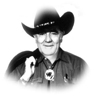
"I think of myself in the oral tradition - as a troubadour, a village tale-teller, the man in the shadows of the campfire.
That's the way I'd like to be remembered - as a storyteller. A good storyteller."
~ Louis L'Amour


Lamour popularized am romaticized the cowboy in our literature. He received his early encouragement from his membership in the Oklahoma Poetry Society. His first works were poems published by the Society. The blogmaster is a member of the society.

RANCH RODEOS:
"Willard Porter, 'One of Oklahoma's Pioneer-Days Steer Ropings Occurred at Bromide in 1913,'"

Monday, March 06, 2006

Wapanucka Press, Johnston Co.1902

Wapanucka Press, Johnston Co.: "Johnston Co.: Wapanucka
Wapanucka Press
January 1902
Arch K MCGILL, Editor
Os. M STEVENS, Manage "

Blogmasters note: Micro film of the Wapanucka newspaer and also the Bromide Gazette (1907-13?) are available at the Oklahoma Historical Society. jdm2006/03/06

Wapanucka Academy at Bromide, Oklahoma


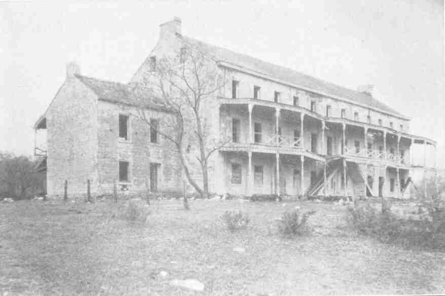
Wapanucka Academy: "Wapanucka Academy, Chickasaw Nation"
The picturesque location of Wapanucka Academy was always an inspiration to those connected with that early day school among the Chickasaws. Its site is on the north side of a high ridge on the upper course of Delaware Creek, about five miles northwest of the town of Wapanucka, in Johnston County. Abandoned and falling in ruins, the limestone building, now gray with age, is like a forgotten manor house in the midst of a vast part, uncared for, yet beautiful in its natural setting. One is impressed with a feeling here is romance that hints of Old England when, standing at a deep set, open casement of this gray walled ruin, he views for the first time the sweeping panorama of the countryside before him. Immediately below at the foot of the ridge to the north are woods marking the course of Delaware Creek hidden in deep shadows. Just beyond to the west, hills sparsely covered with grass round up, snowy with limestone and dotted here and there with clumps of greenery. To the northeast, rolling prairies extend to the hazy blue of hills far away in the distance. Leaving the building for a vantage point on top of the ridge, one looks down to the west into a lovely valley, a continuation of what is now Wells Valley bordered by high wooded hills. It was these scenes that inspired the following letter by Cicero A. Skeen, Superintendent of Wapanucka Institute, dated may 27, 1890. The letter was printed in his former home newspaper, in Randolph County, North Carolina, and is presented for the permanent record of the State of Oklahoma, in connection with this historical sketch of one of the first boarding schools among the Chickasaws in the Indian TerritoryClick link above to read letterjdm2006/03/06

Bromide in the National Register of Historical Places - OKLAHOMA (OK), Johnston County


National Register of Historical Places -
OKLAHOMA (OK), Johnston County
:
"Wapanucka Academy Site ** (added 1972 - Site - #72001065)
Also known as Wapanucka Institute
Address Restricted, Bromide
Historic Significance: Information Potential
Area of Significance: Religion, Education, Historic - Aboriginal
Cultural Affiliation: Chickasaw
Period of Significance: 1850-1874
Owner: Private
Historic Function: Religion
Historic Sub-function: Church School
Current Function: Agriculture/Subsistence
Current Sub-function: Agricultural Fields "

Google Local Bromide Oklahoma Satellite

Google Local

A satellite shot of Bromide Oklahoma.

KTEN TV-Tower Bromide - Wikipedia, the free encyclopedia

KTEN TV-Tower Bromide - Wikipedia, the free encyclopedia:

"KTEN TV-Tower Bromide is a 480.5 metre high guy-wired aerial mast for the transmission ofFM radio and television programs in Bromide, Oklahoma, USA (Geographical coordinates: 34�21'34' N and 96�33'35' W). KTEN TV-Tower Bromide was built in 1984"

Bromide, Oklahoma - Wikipedia, the free encyclopedia

Bromide, Oklahoma - Wikipedia, the free encyclopedia

Sunday, March 05, 2006

: "Johnston County, OK an OKGenWeb Project
OkGenWeb | Cemeteries | Census | Discussion List | Resources |Families | Surnames | Chat with CC's every Sat. @ 9pmCST | Vitals
History | Photos | Books & Newspapers | Home


Wells Valley Cemetery, Johnston County, Oklahoma
It is located about 3 miles southeast of Bromide . It is located in the country on a dead
end road. Its north of highway 48. Many of the Bromide people were buried there
years ago. Not so many now. Most people are now buried at the Rose Hill Cemetery
north of Wapanucka,Oklahoma. "

Friday, March 03, 2006

Wells Valley Cemetary, Bromide Oklahoma

: "Wells Valley Cemetery, Johnston County, Oklahoma
It is located about 3 miles southeast of Bromide . It is located in the country on a dead
end road. Its north of highway 48. Many of the Bromide people were buried there
years ago. Not so many now. Most people are now buried at the Rose Hill Cemetery
north of Wapanucka,Oklahoma."

Monday, February 06, 2006

The Witch Hole West of Bromide


An early scouting party prior to removal of the Chickasaws to Indian Territory camped pool on the bank of Delaware Creek near the present entrance to Camp Simpson. The Witch Hole as it came to be called was formed by water pouring over a cliff and carving out an almost perfectly round pool about the size of half a basketball court. A tribeswoman who was the cook and camp keeper was left at the site while the party surveyed the area. When the party returned from their trip they found buckets by the side of the pool and the woman was missing. The Witch Doctor went into a trance and dived into the pool. He reported going far down into a cave where he found the womans body and was attacked by giant fish have 8 tenacles and a beak. He killed the creature but was mortally wounded in the struggle. He brought the womans body back up and her appendages were all eaten off. Their bodies were buried on the side of the pool. On dark moonless nights people have reported an apparition of a woman in native garb with no fingers, toes, nose and ears walking on the surface of the pool. It is know to this day as the "Witch Hole" and has been the site of numerous drownings (one of which the Blogmaster was witness to), This story comes from a paper delivered in writing class at Bromide High School by Mevlyn Wisdom (now Kirkpatrick).
Scuba gear was brought to the Boy Scout Camp in the 50's and the Blogmaster was present as the divers reported a cave system at a depth of over a hundred feet. They brought up man metal artifacts from the caves from past accidents including wagon wheels, brass items and pottery. Jim Martin, the Blogmasters family farm was a few hundred feet South on the Delaware and many nights were spent camping and fishing with the ghosts of the Witch hole. jdm2006

Quote from ThisNThat Newsletter
Here is a pic of Witch's Hole. Local legend has it that it was an abandon mine of some kind many many years ago, and the shaft down to the mine is where Witch's Hole is located. People say Witch's Hole is over 200 feet deep. And it is full of big bass too, mostly leftovers from the nearby U.S. Fish Hatchery over at Reagan, Oklahoma. They throw into the creek any extra fish they have, and it sure makes the creek that runs through Camp Simpson a fisherman's heaven for those Boy Scouts.
http://members.nbci.com/_Xoom/OklahomaPast/photos/simpson7.jpg